 |
 |
 |
 |
 |
 |
 |
Home - Geological Definitions - Geological Supplies - Submit Location - Travel - United States - Contact
Copyright © 2007-2022 geologicallocations.com. All Rights Reserved.
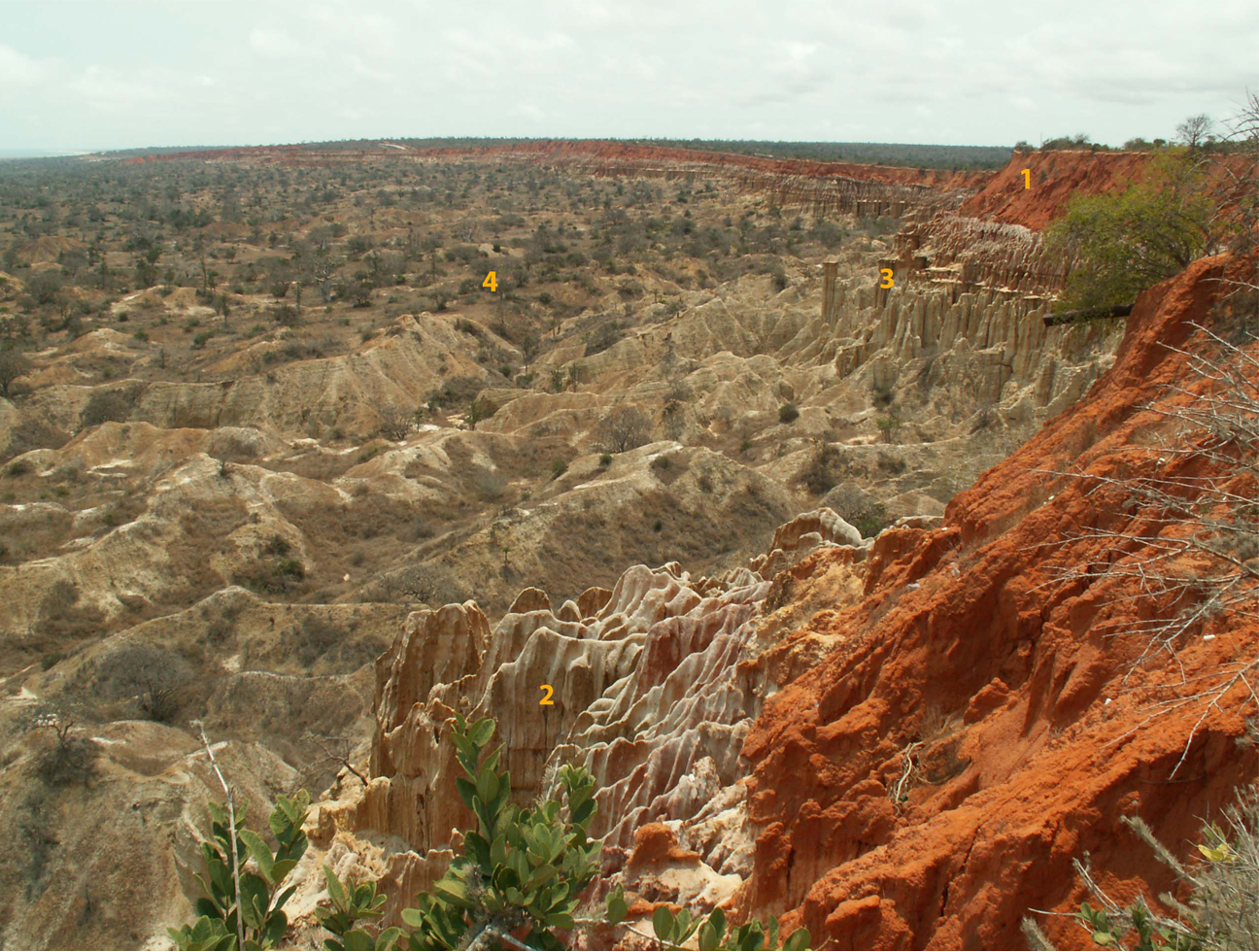
View from the observation point at the 59 th kilometer of the Luanda – Barra-du-Kwanza (Bridge on the river Kwanza). Stratigraphic section of the Pliocene-Quaternary Kalahari (?) formation (marked N2 c-l on the map and as "luanda-cacuaco on the stratigraphic column)– weakly consolidated sandstones and gravels, rhythmically bedded, interbedded with variable grain size sandstones and small gravel pebble layers. Pebble leyers contain subrounded quartz fragments up to 5 x 4-3 x 2.5 cm in size. Upper part of the section is enriched in lateritic iron(1), but without the hard erosional crust (“cuirass”) formation. Sandstones remain sufficiently friable and are easy to dig. An existence of an apparent “dense” horizon at the base of the “sugar-like” sands (2) results in the appearance of the columnar weathering features (3). In the middle of the photo - fragments of the second marine terrace surface (4) severely eroded by temporary ravines. Photo and captions by Oleg Khotylev, Moscow State University